Scorching Start: Jamaica braces for prolonged heat as El Niño looms
Article By: Old Harbour News
-

- May 01, 2026 07:17 AM | News
-
The sudden shift is not a fleeting heatwave. It is the leading edge of a significant climate pattern transition that official forecasts now say will reshape the island’s weather for months to come.
From Neutral to El Niño: What the Science Says
According to the April 9, 2026, ENSO Diagnostic Discussion from the U.S. Climate Prediction Center, the equatorial Pacific has just emerged from La Niña into ENSO-neutral conditions. But that respite will be brief. The report states there is a 61 percent chance that El Niño will emerge by May–July 2026 and persist through at least the end of the year. More striking still: there is a one-in-four chance of a “very strong” El Niño exceeding +2.0°C during the upcoming Northern Hemisphere winter.
For Jamaica, this is not merely a statistical curiosity. El Niño typically generates strong upper-level winds across the Caribbean that shear away moisture necessary for cloud formation and rain. The result: suppressed rainfall, intensified evaporation, and prolonged heat stress.
A Wet Season That May Not Deliver
The timing is especially concerning. Jamaica’s wet season runs from April to October, but the Meteorological Service of Jamaica (Met Service) has already projected below-normal rainfall for April and May – the early wet season months. Head of the Met Service’s Applied Meteorology Division, Ronald Moody, confirmed in March that while the island has experienced unseasonably high rainfall during the dry period (December–March), that trend is unlikely to continue.
“Anything can happen under neutral conditions,” Moody cautioned in March as per the statue-run Jamaican Information Service, “but the onset of El Niño historically tilts the balance toward drought.”
The latest outlook from the August/September Development Authority (BADA) reinforces this. Rainfall probabilities for southern parishes – including Manchester, Clarendon, and St. Catherine – stand at 45 percent for below-normal precipitation between April and June. For Kingston, St. Andrew, St. Thomas, and Portland, the likelihood of below-normal rainfall climbs to 50–55 percent.
Beyond Drought: A Multi-Hazard Regime
The Barbados-based Caribbean Institute for Meteorology and Hydrology (CIMH) is urging governments, farmers, and citizens to prepare not just for dryness but for what Dr. Cedric Van Meerbeeck, CIMH climatologist, calls cascading and compounding hazards.
“This El Niño event is likely to bring periods of reduced rainfall and increased humid heat, affecting water availability and agriculture, and increasing the likelihood of heat stress and dry conditions,” Van Meerbeeck said in an April 21 advisory.
Professor Michael Taylor, co-director of the University of the West Indies Climate Studies Group (UWI CSGM), put it even more starkly: “What we are seeing in the forecasts is the emergence of a potential multi‑hazard regime – where heat, drought, and marine impacts can occur together and reinforce each other. With advance warning of a looming multi‑hazard threat, preparedness is imperative.”
Historically, El Niño has been linked to severe Caribbean droughts – notably 2009–2010 and 2014–2016 – as well as extreme heat, wildfires, and coral-bleaching marine heatwaves. The record heat years of 2010, 2023, and 2024 followed similar patterns.
How Jamaicans Can Adapt: Practical Steps for the Coming Months
While the forecast is sobering, experts agree that proactive adjustment can significantly reduce harm. Here is what households, farmers, and communities can do immediately.
1. Water Conservation as a Daily Discipline
With the early wet season likely to deliver less rain than usual, every drop matters.
- Harvest rainwater now while March’s unseasonal showers still leave some moisture. Clean gutters and install barrels or tanks.
- Reuse greywater from washing (using biodegradable soaps) for irrigation.
- Fix leaks immediately – a dripping tap can waste 20 litres per day.
- Store emergency water in clean, covered containers for drinking and cooking.
2. Smart Farming for Heat and Dry Spells
The BADA and Met Service both urge farmers to abandon the traditional “slash and burn” land-clearing method, which risks uncontrolled bushfires under dry, hot conditions.
- Shift planting schedules to very early morning or late evening to reduce heat stress on crops.
- Use mulch (dried grass, leaves, or coconut husks) to retain soil moisture and cool root zones.
- Plant drought-resilient varieties – cassava, sweet potato, pigeon peas, and local herbs like thyme and scotch bonnet pepper (with adequate shade).
- Install shade cloth over nurseries and young plants. Even 30 percent shade can reduce temperature stress significantly.
- Irrigate at night or pre-dawn to minimise evaporation.
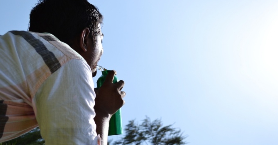
3. Personal Health: Beat the Heat
With 30°C by 9:00 a.m., heat exhaustion and heatstroke become real risks – especially for outdoor workers, the elderly, and young children.
- Limit outdoor exertion between 10:00 a.m. and 3:00 p.m. If work is unavoidable, take frequent shaded breaks.
- Hydrate before thirst strikes – drink water steadily, not just when parched. Avoid sugary drinks, alcohol, and excessive caffeine.
- Dress lightly in loose, light-coloured, natural-fibre clothing.
- Check on vulnerable neighbours – particularly those without fans or easy access to cool spaces.
- Recognise warning signs: dizziness, headache, nausea, rapid heartbeat, or cessation of sweating. Move to a cooler area and seek medical help if symptoms persist.
4. Home and Infrastructure Adjustments
Improve natural ventilation – open windows on opposite sides of rooms to create cross-breezes.
- Reflect heat – paint roofs with white or reflective coating; install awnings or exterior shutters.
- Use fans strategically – a ceiling fan set to rotate counter‑clockwise pushes cool air down.
- Limit heat-generating appliance – cook outdoors or during cooler evening hours; air-dry laundry instead of using a dryer.
5. Fire Prevention
Dry vegetation plus high heat equals elevated fire risk.
- Do not light bushfires for land clearance – use mechanical clearing or grazing instead.
- Clear dry brush at least 10 metres from homes and fences.
- Keep a water source or fire extinguisher accessible during any outdoor burning of permitted materials.
What the Months Ahead Look Like
Not every parish will experience identical conditions. BADA’s Francie Wade notes that for July–September, some parishes – particularly central St. Thomas – may see slightly higher-than-normal rainfall as wind patterns shift. However, “even though you’re going to get higher than normal rainfall for that period, it still doesn’t mean you’re going to be overall wetter,” she cautioned. The island-wide trend remains tilted toward dryness and heat.
Crucially, while El Niño typically suppresses Atlantic hurricane activity, climatologists warn against complacency. As Dr. Van Meerbeeck noted, a single hurricane or intense rainfall event – like Hurricane Andrew in The Bahamas (1992) or Tropical Storm Erika in Dominica (2015) – can cause catastrophic damage even in an otherwise quiet season.
A Call for Early Action
The early-morning heat already pressing down on Jamaica is not an anomaly. It is a signal. The ocean subsurface temperatures across the Pacific have warmed for five consecutive months, westerly wind anomalies are building, and every major climate model now points toward an El Niño that could rival the strongest events of the past two decades.
Professor Taylor’s words bear repeating: “With advance warning of a looming multi‑hazard threat, preparedness is imperative.”
For Jamaica, that means adjusting now – not waiting for the peak of heat or the first tap to run dry. Conserve water. Adapt farming methods. Protect personal health. And above all, stay informed. The next ENSO Diagnostic Discussion will be released on May 14, 2026, offering clearer guidance on just how strong this El Niño will become.
Until then, Jamaicans would do well to treat these 9:00 a.m. 30-degree mornings as exactly what they are: a dress rehearsal for a hotter, drier future that has already arrived at our doorstep.


")